
The Six Foot Track stands as one of Australia’s most celebrated walking trails, stretching 44 kilometres from Katoomba in the Blue Mountains to the legendary Jenolan Caves. Originally constructed in the 1880s to provide horse and cart access to the caves, this historic route now attracts thousands of hikers and trail runners each year who come to experience its dramatic landscapes, pristine wilderness, and challenging terrain.
The track’s name refers to its original width specification, though nature has since reclaimed much of the path. Today’s adventurers follow in the footsteps of early explorers, descending from the Blue Mountains plateau through eucalypt forests, crossing river valleys, and climbing ridges that showcase some of New South Wales’ most spectacular backcountry scenery.
Track Sections and Highlights
The Blue Mountains Six Foot Track divides naturally into three distinct sections, each offering unique challenges and rewards. The full journey typically takes experienced hikers 2-3 days to complete, with elevation changes totalling over 1,200 metres of ascent and descent. The track passes through the Blue Mountains National Park and Kanangra-Boyd National Park, providing opportunities to spot native wildlife, including wallabies, wombats, and countless bird species.
Katoomba to Megalong Valley
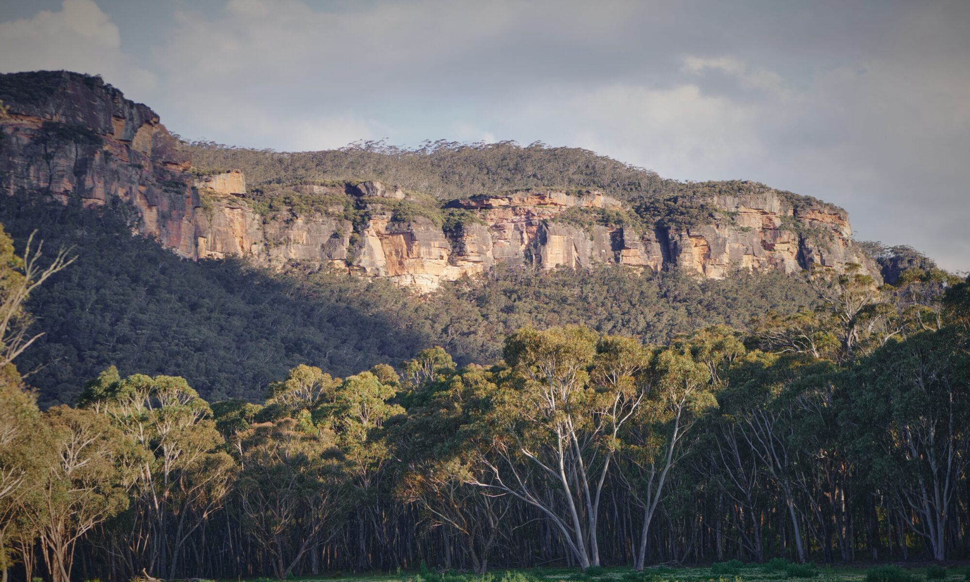
The first 14 kilometres begin at the Explorers Tree near Katoomba’s outskirts, descending sharply into the Megalong Valley. This section presents several key features:
- The descent: Approximately 600 metres through dense eucalypt forest, with the Nellies Glen track junction offering spectacular valley views. The steep gradient can be tough on knees, particularly after rain when the track becomes slippery.
- Valley floor: The terrain flattens dramatically as you cross pastoral land with the Narrow Neck plateau forming an impressive backdrop. This contrast from mountain forest to open farmland creates one of the track’s most memorable transitions.
- Time and distance: This section typically takes 4-5 hours and ends at the Megalong Valley camping area, where many hikers spend their first night before continuing deeper into the wilderness.
Megalong Valley to Coxs River
Spanning roughly 15 kilometres, this middle section showcases the track’s most diverse landscapes. You’ll cross farmland before entering forest and descending to the Coxs River, the trail’s lowest point at approximately 400 metres elevation. The Bowtells Swing Bridge provides a memorable river crossing, swaying gently as you traverse above the clear mountain water.
This section includes the Alum Creek campsite and ends at the Coxs River camping area, where most overnight hikers choose to stop. The combination of valley walking and gradual climbs makes this a moderate 5-6 hour section that allows time to enjoy the changing scenery and perhaps cool off in the river during warmer months.
Coxs River to Black Range
The final 15 kilometres present the track’s greatest challenge, climbing 700 metres from the Coxs River to the Black Range before descending to Jenolan Caves. The ascent through forest to Mini Mini Saddle tests even fit walkers, though the effort rewards you with panoramic views across the wilderness.
After cresting the range, the track descends through woodland to emerge at the Jenolan Caves Reserve, where the Grand Arch provides a spectacular finishing point. Allow 6-7 hours for this demanding section, starting early to ensure you complete the climb before the afternoon heat builds.
Key Crossings and Bridges
Water crossings define much of the Six Foot Track experience, with conditions varying dramatically between seasons:
- Bowtells Swing Bridge: The most significant crossing at Coxs River features this narrow suspension bridge that adds adventure to your journey. While generally stable, the bridge’s movement can unsettle nervous crossers. During flood conditions, this crossing becomes impassable, and walkers must wait for water levels to recede.
- Six Foot Track Guyver Bridge: Located near the Megalong Valley section, this more substantial structure remains suitable for all weather conditions. Unlike Bowtells, it provides a stable crossing year-round.
- Creek crossings: Several smaller creeks along the route may require rock-hopping or wading during wet periods, making waterproof boots recommended regardless of season.
Accommodation and Camping
Overnight walkers have several accommodation options along the Six Foot Track. The NSW National Parks and Wildlife Service maintains two official camping areas at Megalong Valley and Coxs River, both offering basic facilities including pit toilets and water access (which must be treated before drinking). Sites operate on a first-come basis and fill quickly during peak periods, particularly Easter and long weekends. Camping permits are required and can be obtained through the NPWS website before your departure.
Additional camping at Alum Creek offers a quieter alternative between Megalong Valley and Coxs River, though facilities are more basic. All campers should register their trip and obtain necessary permits before setting out.
Six Foot Track Eco Lodge
For those preferring more comfort, the Six Foot Track Eco Lodge at Megalong Valley provides a luxurious alternative:
- Comfortable beds and hot showers after a long day’s hiking
- Meals included, eliminating the need to carry cooking equipment
- Strategic location at the day-one endpoint allows lighter packs on the opening descent
- Accepts both guided tour groups and independent bookings
Private accommodation also exists at both trail ends in Katoomba and Jenolan Caves, allowing flexible itinerary planning.
Six Foot Track Events
The Six Foot Track Marathon ranks among Australia’s premier trail running events, attracting over 900 participants annually since its 1984 inception. Despite its name, the Six Foot Track race covers the full 45-kilometre course, with runners tackling the challenging terrain in a single day. Elite competitors finish in under four hours, while the seven-hour cutoff accommodates recreational runners and fast hikers.
Held annually in March, the event transforms the usually peaceful track into a competitive arena. The race starts at 6:00 AM from Katoomba, with participants streaming down the Megalong descent before the day’s heat builds. Multiple aid stations provide water and nutrition, while volunteers from the Blue Mountains Rural Fire Service stationed at key points ensure runner safety. The event operates as a not-for-profit initiative, with all proceeds donated to the rural fire service.
Registration typically opens in November and operates through a lottery system due to high demand, with entry fees around $240. Race entry includes transport back to Katoomba from the finish line, timing chips, and a finishers’ bag. The event also offers a relay option for teams wanting to share the challenge across different sections of the track.
Guided Tours and Support
Six Foot Track Life’s An Adventure operates the most established guided walking tours along the route, offering fully supported multi-day treks. Their packages include accommodation at the eco lodge, meals, pack transfers, and experienced guides who share insights into the region’s natural and cultural history. This option suits walkers wanting to focus on the experience without logistical concerns.
Other operators provide variations, including self-guided packages with pack transfers, allowing independent hiking with lighter loads. These services transport your overnight gear between accommodation points while you carry only day-pack essentials. For ultra-light enthusiasts and experienced bushwalkers, the track is entirely manageable independently, with water sources along the route (treatment essential) and well-marked trails requiring only basic map-reading skills.
Preparation and Safety Tips
Successful Six Foot Track completion requires proper preparation across several key areas:
Essential Gear
- Sturdy hiking boots (worn-in, not new) to prevent blisters on the long descent
- Three-season tent for camping, capable of handling mountain weather
- Water purification tablets or a filter, as all natural water sources require treatment
- First aid kit including blister treatment and pain relief
- Navigation tools, including a map, a compass, and GPS backup
- Sufficient food for your planned journey plus one extra day
- Warm and waterproof layers, regardless of the forecast, as the weather can change rapidly
Safety Considerations
- Register your walk with the NPWS and leave detailed plans with friends or family
- Carry at least 3 litres of water capacity, as sources can be scarce between sections
- Mobile coverage is nonexistent through most sections, making emergency communication impossible without a satellite device
- Personal Locator Beacons can be hired for free at the Blue Mountains Heritage Centre in Blackheath
- Start early each day to avoid afternoon heat and ensure adequate daylight for navigation
- Attempt river crossings during morning hours when water levels are typically lowest
- The track’s remote nature means help can take hours to arrive, so self-sufficiency is crucial
Best Times to Visit
Spring and autumn offer ideal conditions with mild temperatures and lower rainfall probability. Summer brings heat that makes the exposed sections challenging, while winter can deliver snow to the Black Range. Check fire danger ratings before departure, as total fire bans may close the track during extreme conditions.